Cambridgeshire and Huntingdonshire
Family History Society

Cambridgeshire and Huntingdonshire
Family History Society
Meldreth is a village and civil parish in South Cambridgeshire, England, located around 10 miles southwest of Cambridge.
A large Bronze Age hoard was found near Meldreth railway station in the nineteenth century that is now in the collections of the British Museum.
Listed as Melrede in the Domesday Book of 1086, the village's name means "mill stream", named after the stream that rises at Melbourn Bury and flows north into the River Rhee. Due to its proximity to Cambridge, much of the land has at some time been owned by colleges of the University of Cambridge.
In the early 16th century, Christ's College moved to its Meldreth estate to escape the plague.
In 1952, the Royal Train carrying King George VI's body passed through the station on its journey from Sandringham to London. Residents gathered on the platform to pay their last respects to the King.
CALDECOTE, a parish in the hundred of NORMAN-CROSS, county of Huntingdon, 1.25 miles (W.S.W.) from Stilton, containing 51 inhabitants. The living is a discharged rectory, in the archdeaconry of Huntingdon, and diocese of Lincoln, rated in the king's books at £ 7.36, and in the patronage of James Kelwell, Esq. The church is dedicated to St. Mary Magdalene. In 1769, the Rev. James Oram bequeathed £ 250, directing the interest to be applied in supporting a school for girls. This extract is from "Samuel Lewis Topographical Gazeetter - 1831"
Caldecote was originally in the Peterborough Registration District of Northamptonshire from 1st July 1837. Subsequently it was transferred to the Stilton sub-District of Huntingdonshire. It was later transferred back to the Peterborough District. From 1st April 1998, marriage records were transferred to the Huntingdon Registry Office, but the births and burial records were retained by Peterborough.
There is also a Caldecote in the old county of Cambridgeshire about six miles west of Cambridge.
www.en.wikipedia.org/wiki/Caldecote,_Huntingdonshire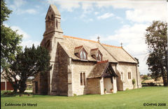
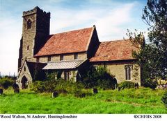
WOODWALTON, is a parish in the hundred of Normancross, in the County of Hunts, 8 miles north of Huntingdon, and 6 miles south-east of Stilton, on the border of the Fens. The medieval church is dedicated to St. Andrew and was closed in 1967, then declared officially redundant in 1970. Burials still take place in the churchyard at Woodwalton, but the church itself is now under the care of Friends of Friendless Churches
The stained glass windows from the Church are currently on loan to the Ely Stained Glass Museum
In the 1851 census, there are 375 people living in Woodwalton in 69 dwellings with 5 further men living in barns or sheds. The largest household is that of Thomas Payne, a publican at Upper End where 13 people are listed. One of them is the youngest resident of Woodwalton, Thomas Payne's unnamed daughter aged 1 week. The Woodwalton Parish records show us this is Martha Payne, baptised in July 1851. John Measures is also 1 week old in the 1851 census and was baptised in 1857 aged 6 years. The oldest residents in the 1851 census are Joseph Wright and Thomas Simpson. Joseph was born in Yaxley but the parish register reveals he was buried in Woodwalton in 1859. Thomas was baptised in Woodwalton in 1776 and buried in 1852.
The place-name 'Boxworth' is first attested in the Domesday Book of 1086, where it appears as Bochesuuorde. It appears as Bukeswrth in 1228 in the Feet of Fines. The name means 'Bucc's enclosure or homestead'.
In the 1664 Hearth Tax, a large house belonging to a gentleman, Mr Killingworth, accounted for eight hearths at Boxworth.
Boxworth's population, once considerable, shrank severely after the Middle Ages before recovering to reach a peak of c350 in the mid-19th century.
In 1870–1872, John Marius Wilson's Imperial Gazetteer of England and Wales described Boxworth thus:
"BOXWORTH, a parish in the district of St. Ives and county of Cambridge; 3 miles WSW of Long-Stanton r. station, and 5 SSE of St. Ives. Post Town, Long-Stanton, under Cambridge. Acres, 2,521. Real property, £2,946 Pop., 347. Houses, 64. The property is divided among a few. The living is a rectory in the diocese of Ely. Value, £459.* Patron, G. Thornhill, Esq. The church has a monument of Sanderson, the blind professor of mathematics; and is good."
https://en.wikipedia.org/wiki/Boxworth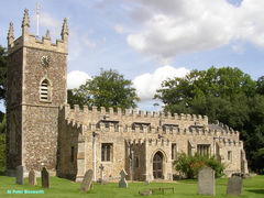
Little St Mary's or St Mary the Less is a Church of England parish church in Cambridge, England, on Trumpington Street. The church is in the Diocese of Ely and follows the 'Anglo-Catholic' or 'high-church' tradition of the Church of England.
There has been a place of worship on the current site since around the twelfth century. The earliest known records of the church state that the first church here was called St Peter-without-Trumpington Gate, to distinguish it from St Peter by the Castle (or ad castrum). It was controlled by three successive generations of the same family until 1207. After that date it was given to the Hospital of St John the Evangelist and served by chaplains from that foundation.
In the early 1280s, Hugh de Balsham, Bishop of Ely, lodged some scholars in the Hospital but to his dismay found soon that the sick and the students could not live in harmony together. The students were moved in 1284 to the site of what is now Peterhouse; this was the origin of the first Cambridge college. By the 1340s the church was in such a bad state that the fellows of Peterhouse decided to rebuild it. In 1352, the new building had the dual purpose of College Chapel (to Peterhouse) and Parish Church. At this time, it was rededicated to the Blessed Virgin Mary. In 1632 Peterhouse built a separate Chapel and St Mary the Less reverted to being solely a Parish Church.
https://en.wikipedia.org/wiki/Little_St_Mary%27s,_Cambridge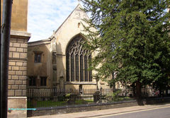
Bottisham is a village and civil parish in the East Cambridgeshire district of Cambridgeshire, England, about 6 miles (10 km) east of Cambridge, halfway to Newmarket. According to the 2001 census it had a population of 1,983, including Chittering, increasing to 2,199 at the 2011 Census.
The Church of the Holy Trinity has some of the finest fourteenth-century work in the county. The tower and the chancel with its stone seats are thirteenth century but the nave and aisles and porches are all from the fourteenth.
A table tomb within the church has the mark of a vanished monumental brass portrait of Elias de Beckingham, who was said to be with one exception the only honest judge in the reign of King Edward I. Only he and one other were acquitted when every judge was charged by the king with bribery. A sculptured monument of three centuries later (1598/9) shows Margaret (née Coningsby) kneeling behind her second husband, Thomas Pledger, both in black robes and ruffs. Cherubs hold back the curtains of a stone canopy to show two children asleep with flowers in their hands, Leonard and Dorothea Alington (whose family had an estate nearby), of whom the inscription of 1638 tells:
These the world's strangers were, not here to dwell.
They tasted, like it not, and bade farewell.
The east window and a tablet close by are in memory of Colonel Soame Gambier-Jenyns, who rode (as a Captain) down the Valley of Death at Balaclava, and survived. Other memorials to this family, whose home, Bottisham Hall, was rebuilt in 1797, show Sir Roger Jenyns and his wife sitting on their tomb holding hands, with dressing-gowns thrown over their night things as if they had just woken from sleep. Their son, Soame Jenyns, was for 38 years a Member of Parliament, a keen debater, and is remembered here by angels garlanding an urn.
There are some pictures and a description of the church at the Cambridgeshire Churches website.
You can join our Facebook Bottisham Ancestors Family History Group here.
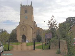
Friday Bridge is a village in Elm civil parish, part of the Fenland district of Cambridgeshire, England. It is 3 miles south of Wisbech.
In 1838 a Wesleyan Methodist congregation was established and a chapel in 1843.
The ecclesiastical parish was formed on 3rd July 1860 from the civil parish of Elm. St Mark's Church of England parish church, designed by J. B. Owen opened in 1865. The church is now Grade II listed. A church day school was opened in 1871. The Wisbech Water Works Co Ltd Water Tower was completed in 1894. The Friday Bridge county secondary modern school was opened in 1928.
The clock tower in the village is the war memorial. Friday Bridge was the site of a World War II prisoner of war camp which was converted to a hostel for migrant workers in the late 1940s.
en.wikipedia.org/wiki/Friday_Bridge,_Cambridgeshire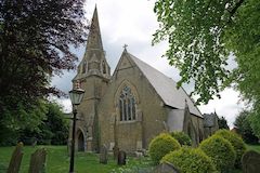
Fenstanton is a village and civil parish in Cambridgeshire, England, 2 miles (3 km) south of St Ives in Huntingdonshire, a non-metropolitan district of Cambridgeshire and historic county. Fenstanton lies on the south side of the River Ouse.
Known as Stantun in the 11th century, Staunton and Stanton Gisbrit de Gant in the 13th century, the name Fenstanton (and Fennystanton) appeared from the 14th century. The name "Fenstanton" means "fenland stone enclosure".
Fenstanton was listed in the Domesday Book in the Hundred of Toseland in Huntingdonshire; the name of the settlement was written as Stantone in the Domesday Book. In 1086 there was just one manor at Fenstanton; the annual rent paid to the lord of the manor in 1066 had been £17 and the rent had fallen to £16 in 1086, and the parish contained 33 households. By 1086 there was already a church and a priest at Fenstanton.
en.wikipedia.org/wiki/Fenstanton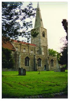
Cottenham is a village in Cambridgeshire, England. Cottenham is one of the larger villages surrounding the city of Cambridge, located around five miles north of the city. The population of the civil parish at the 2011 Census was 6095. Cottenham is one of a number of villages that make up the historical Fen Edge region in between Cambridge and Ely, which were originally settlements on the shore of the marshes close to the city of Cambridge, then an inland port.
The parish is recorded in the Domesday Book of 1086 as housing 60 tenants, however the population fluctuated until the 13th century when the parish boundaries became somewhat fixed and pastures were enclosed. River transportation along the River Great Ouse which lies to the north of the parish was extremely important throughout the Middle Ages, establishing Cottenham as a trade route in between Cambridge and the surrounding Fens, resulting it becoming one of the largest villages in Cambridgeshire from the 11th century onwards.
en.wikipedia.org/wiki/Cottenham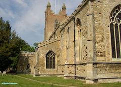
The Church of the Holy Sepulchre, generally known as The Round Church. The church was built around 1130, its shape being inspired by the rotunda in the church of the Holy Sepulchre, Jerusalem. It was built by the Fraternity of the Holy Sepulchre, who were probably a group of Austin canons. It consisted of a round nave and an ambulatory, with a short chancel, probably in the shape of an apse. Initially it was a wayfarers' chapel on the Roman road known as Via Devana (this is now Bridge Street). By the middle of the 13th century it had become a parish church under the patronage of Barnwell Priory.
en.wikipedia.org/wiki/Church_of_the_Holy_Sepulchre,_Cambridge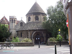
The parish of Stetchworth is long and thin in shape, around six miles long and one mile wide and covering an area of 2,891 acres (1,170 ha). It stretches southeast from Newmarket Heath to the border with Suffolk. Its relatively straight north-east border with Burwell and Woodditton follows the Devil's Dyke to its southern end just west of Ditton Green, from where the border follows field boundaries. Its long western border with Dullingham also follows field boundaries, most of which also follow the course of the Stour Valley Path, a long-distance footpath. It also has a short border with Kirtling at the southeastern end and another with Swaffham Prior at its northwest edge
The village had 25 inhabitants at the time of the Domesday Book in 1086 when the parish was owned by Hardwin of Scales, the Abbot of Ely, and Count Alan. The Domesday Book also mentions that Stetchworth was "once a town".
Listed as Steuicheswrthe in around 1050 and Stiuicesuuorde in the Domesday Book of 1086, the name "Stetchworth" either means "enclosure amongst the tree-stumps" or "enclosure of a man called Styfic".
en.wikipedia.org/wiki/Stetchworth
The village name means 'higher well (= spring/stream)'. Originally, part of a single place called Well; 'upp' was appended to distinguish from Outwell.
Upwell in 1202 had a market-place and a weekly market. Marmont Priory was endowed by Richard I with 300 acres in Upwell and Outwell. The priory of Gilbertines was founded in the reign of King John. Cultivation of flax and hemp is referred to in an order of Sessions of Sewers in 1340. Upwell was connected with Wisbech by a steam tramway in 1884.
William Wolsey a constable of Upwell, Outwell & Welney (and Robert Piggot of Wisbech) Protestants were tried at Ely for heresy and burnt at the stake in 1555.
In 1810 a building was being used as a temporary theatre by Joseph Smedley at a cost of five Guineas.
In 1869 Upwell St Peter, was the richest benefice of the English church, being returned in the clergy list as worth £3,058 a year, though worth considerably more, and had just become vacant by the death of the Rev. William Gale Townley, who had held it only seven years. The living was in the gift of B. G. Townley. In the same parish was the rectory of Christ Church, returned as being worth £1,594 year, also belonging to the Townley family.
en.wikipedia.org/wiki/Upwell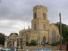
Kimbolton is a town and civil parish in the Huntingdonshire district of Cambridgeshire, England. Kimbolton is about 9 miles (14 km) west of Huntingdon and 14 miles (23 km) north of Bedford.
Kimbolton was also situated within historic Huntingdonshire when it was a county of England. The parish includes the hamlet of Stonely. Catherine of Aragon, after her divorce from Henry VIII, died at Kimbolton Castle in 1536.
Archaeological discoveries near to the airfield indicate the possible presence of a Roman settlement. The name Kimbolton, however, is Anglo-Saxon, translating as “Cenebald’s ton” (an enclosure or homestead).
Kimbolton, and the lands of its soke, comprised the only estate of King Harold in Huntingdonshire. It is believed that Harold had a hunting lodge nearby. The town was listed as Chenebaltone and Kenebaltone in the Domesday Book of 1086 in the Hundred of Leightonstone in Huntingdonshire. The survey records that there were 20 ploughlands at Kimbolton in 1086 and, in addition to the arable land, there were 70 acres (28 hectares) of meadows, 3,784 acres (1,531 hectares) of woodland and a water mill. There was already a church and a priest at Kimbolton.
The parish church of St Andrew is Grade I listed. Many members of the Montagu family (Earls and Dukes of Manchester of Kimbolton) are buried at St Andrew's. Several Montagu monuments still exist in the South Chapel, while the Montagu vault (extended in 1853) is located beneath the North Chapel.
The parish also includes the hamlet of Stonely, site of the former Augustinian Stoneley Priory.
en.wikipedia.org/wiki/Kimbolton,_Cambridgeshire
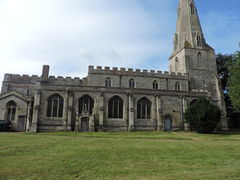
Willingham is located approximately 12 miles (19 km) northwest of Cambridge, on the B1050 road, Willingham Parish occupies 4,641 acres (1,878 ha),
The name Willingham probably originated from being the homestead of the family or followers of a man called "Wifel" and was called Vuivlingeham c. 1050 and Wivelingham around 1086. The name Wivelingham was also used to refer to the village until the 18th century.
The area at the edge of the fens to the north of the present village was already occupied by the 2nd century, though these were at some point abandoned. The Aldreth causeway, which formed the main route between Cambridge and Ely in medieval times and perhaps dating from the Bronze Age, runs through the east of the parish past Belsar's Hill, and until the opening of the Cambridge-Ely turnpike in 1768, carriage traffic would have run through Willingham.
One of the oldest houses in the village dates from the 15th century. Willingham's history is closely associated to its position on the edge of the Fens and it was only with the major efforts to drain the Fens during the 17th century that the parish took its modern structure. During the Middle Ages, the majority of the low-lying land in the parish was inundated annually, and the village had two permanent meres, with the larger of the two growing to 380 acres (150 ha) at times of highest water level. It was only with the construction of the sluice at Earith in 1650 which diverted the flow of the Ouse from the Old West into the New Bedford River that the parish was able to remain largely unflooded. Additional areas were drained by windmills until replaced by steam pumps in the mid-19th century.
Willingham's registered population grew from 23 at the time of the Domesday Book in 1086 to 79 in 1251, and in 1377 the poll tax was paid by 287 adults. By 1801 the population was almost 800 inhabitants growing to more than 1,600 in 1851 despite a wave of emigration to America in the 1830s.
en.wikipedia.org/wiki/Willingham,_Cambridgeshire

The parish of St Andrew the Less is also known as Barnwell. From the 1840s the term New Town often appears to denote parishioners are from the new development in the Hills Road area of the parish, later served by St Paul’s Church. The early church was often also referred to as “The Abbey” or “The Abbey Church” but when this building fell into disrepair a new church, in a
different location on Newmarket Road was built. This church is known as Christchurch, even though the parish remained St Andrew the Less.
Originally the parish included all the area from the river at Midsummer Common, to Fen Ditton, and Cherry Hinton round to Hills Road, the area of Brooklands and Newtown to Lensfield Road, Parker’s Piece and back to the Burleigh Street area. This was later sub divided into the ecclesiastical parishes of St Matthew, St Paul, St Barnabas and St Philip as the population overwhelmed the original church.
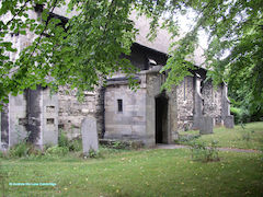
Sutton or Sutton-in-the-Isle is a village and civil parish in the county of Cambridgeshire in England, near the city of Ely. The "in-the-Isle" suffix refers to the fact that the village is part of the Isle of Ely, once an island in the Fens and also an administrative county until 1965.
The village was mentioned in the Domesday Book of 1086, identified as Sudtone. There were then 9 sokemen, 8 villeins (each with 7.5 acres), 15 cotters and 7 serfs.
In 1109, the charter 51 of Bishop Hervey included Suttune in the lands recorded as being conferred upon the Cathedral Priory of Ely. According to the Ely Diocesan Register, the Manor of Sutton was established in 1292 and belonged to the Priory. In 1312, Sutton was granted the right to hold a street market each Thursday; this was held on the broader part of the High Street, outside what is now the One Stop Shop. During the 14th century, the Sutton resident Reginald de Beringhale also became a major landowner, further developing his father's programme of land acquisition.
The vicarage of St Andrew's was instituted in 1254, and the re-building of the church started between 1350 and 1360. It was completed by 1388. With two octagons atop each other crowning its square tower, it is reminiscent of Ely Cathedral, from whom it enjoyed patronage. It has a distinctively shaped tower that is often described as being in the shape of a pepper pot. Several non-conformist chapels once also existed in the village. These included a Methodist chapel constructed in 1790, following a visit by John Wesley in 1774, and a Baptist chapel built in the same century. Both of these closed in recent decades, leaving the Anglican church as the sole place of worship.
By 1599, the village was so prosperous that it became known as "Golden Sutton." In 1800, it had a population of about 950, quickly rising to 1,862 by 1851.
Although a school had been established in the village in 1579, under William Heye, it was not until 1860 that the first purpose-built school building opened. John Taylor was the first headmaster for the boys, and his wife was the headmistress for the girls. The school continues to this day and has expanded to serve the village's growing population.
A railway station was opened in 1866, with the Great Eastern Railway inaugurating passenger-train services to Ely on 16 April. The railway line was later extended round the edge of the fen to Earith Bridge and onto St Ives, with this branch opening on 11 May 1878
en.wikipedia.org/wiki/Sutton-in-the-Isle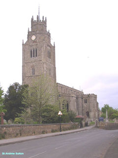
The name Gorefield first appears in a manuscript from 1190. Gorefield as a developing village dates to the 19th and 20th centuries. The Church of St Paul was built in 1870 at a cost of £2,000 with the formation of the ecclesiastical parish of Gorefield from Leverington under the Leverington Rectory Act.
The corner-stone of the new church was laid on 28 April 1870 by Edward Bowyer Sparke, Esq., son of the late rector of Leverington. The church was built of flint with freestone dressings, the whole cost of the building having been provided for by the late Canon Sparke.
en.wikipedia.org/wiki/Gorefield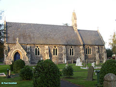
Buckden is a village and civil parish 3.7 miles (6.0 km) north of St Neots and 4 miles (6.4 km) south-west of Huntingdon, England. It includes the hamlets of Stirtloe and Hardwick.
In the centre of the village is Buckden Towers, once Buckden Palace, a residence of the bishops of Lincoln from the 12th to early 19th centuries. Several kings of England stayed there and Catherine of Aragon was held there in 1533 before being moved to Kimbolton Castle in 1534.
Buckden prospered in the 18th and early 19th centuries from being just over 50 miles (80 km) north of London on the Great North Road, which was a busy coaching road at the time. The development of the railways in the mid-19th century led to a decline in the population, but it more than doubled in the second half of the 20th century.
Recorded in the Domesday Book of 1086 as Bugedene, Buckden has also been referred to as Buggeden (12–13th centuries), Bokeden (13th–14th centuries), Bukeden (13th–14th centuries), and Bugden (15th–18th centuries), with the present spelling taking over in the 18th century. The name originates from Old English; "Bucge" is a personal name and "dene" an Old English word for valley. The name is still pronounced Bugden locally.
en.wikipedia.org/wiki/Buckden,_Cambridgeshire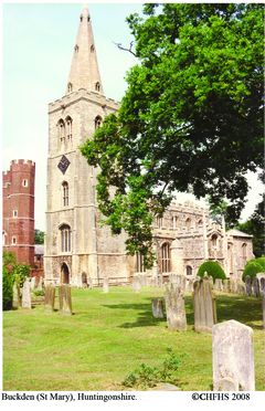
Fen Ditton lies on the east bank of the River Cam, on the road from Cambridge to Clayhithe.
The site has been occupied since at least neolithic times, and stone tools have been found on the meadows between the village and the river.
The name was first recorded in around 950 as Dittone, meaning "the village by the ditch", derived from the Fleam Dyke, the prehistoric ditch that passed through the village from the river to the edge of the fens at Stow-cum-Quy and can still be seen just to the east of the village. The name was later changed to its present name to distinguish it from Wood Ditton.
The village's history is closely connected to its position on the River Cam, which provided trade throughout the medieval period and its principal connection to other settlements. A large wharf at the western end of the High Street allowed goods to be delivered for the annual Stourbridge Fair between the 12th and 14th centuries, but trade declined in later centuries. The wharf was still in use in 1845, but the opening of the London-Cambridge railway line removed its commercial purpose and it closed. More recently the river has been used primarily for leisure purposes.
A paper mill was opened in the parish in around 1550, only the second recorded in England. Standing on Coldham's Brook at the junction of modern-day Ditton Walk and Newmarket Road it had fallen out of use by the early 19th century; it is now occupied by offices.
The Church of England parish church of St Mary The Virgin was built in the 12th century. Made from Barnack stone and rubble with clunch and limestone dressings, it consists of a chancel, nave, north and south aisles, a south porch, and west tower. Some original 12th-century masonry survives, and the tower dates from the 13th century. It is topped by a weather vane in the form of a rowing eight.
en.wikipedia.org/wiki/Fen_Ditton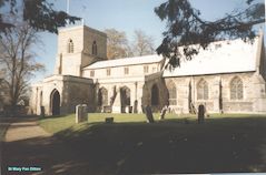
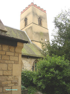
St. Edward's church, in St. Edward's passage, opposite to King's College, is an ancient building of stone in the Early English and later styles, consisting of chancel, with side chapels, nave, aisles and an embattled western tower containing 6 bells: there are several interesting monuments and 280 sittings, of which 10 are free. The register dates from the year 1557, and records the death of Elinor Bowman, 17 Aug.1650, at the age of 112 years. The living is donative, net yearly value £64, in the gift of the Master and Fellows of Trinity Hall, and held since 1893 by the Rev. Frederick Watson D.D. of St. John' s College, Cambridge, hon. canon of Ely and examining chaplain to the Bishop of St. Alban's.
[Kelly's Directory - 1900]
Mepal's history has always been tied up with that of The Fens and the village is less than ten metres above sea level. One of the smaller villages of the Isle of Ely, Mepal lies at the western end of the Isle on what was once the shore between the fenland and the higher ground of the Isle.
The Old Bedford River and the New Bedford River (also known as the Hundred Foot Drain) run very close on the northwestern side of the village, and the only important bridges of the rivers are found in Mepal. The old and new rivers, originally modified by the Victorians, offer the main drainage route for the Fens and retain a major flood plain between the two river beds. The flood plain typically floods between November and March of each year.
A major fire devastated the village in the 19th century, leading to a drop in population from 510 to 397 between 1861 and 1871. There are thus very few remaining buildings dating from before the 19th century.
en.wikipedia.org/wiki/Mepal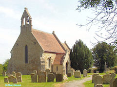
Whittlesey appears in the Cartularium Saxonicum (973 CE) as 'Witlesig', in the 1086 Domesday Book as 'Witesie', and in the Inquisitio Eliensis. The meaning is "Wit(t)el's island", deriving from either Witil, "the name of a moneyer", or a diminutive of Witta, a personal name; + "eg", meaning "'island', also used of a piece of firm land in a fen."
Before the fens were drained, Whittlesey was an island of dry ground surrounded by them. Excavations of nearby Flag Fen indicate thriving local settlements as far back as 1000 BCE. At Must Farm quarry, a Bronze Age settlement is described as "Britain's Pompeii" due to its relatively good condition. In 2016 it was being excavated by the University of Cambridge's Cambridge Archaeological Unit. At Must Farm at least five homes of 3,000 years in age have been found, along with Britain's most complete prehistoric wooden wheel, dating back to the late Bronze Age.
Whittlesey was linked to Peterborough in the west and March in the east by the Roman Fen Causeway, probably built in the 1st century CE. Roman artefacts have been recovered at nearby Eldernell, and a Roman skeleton was discovered in the nearby village of Eastrea during construction of its village hall in 2010.
The town's two parishes of St Mary's and St Andrew's belonged to the abbeys in Thorney and Ely respectively until the Dissolution of the Monasteries about 1540. Despite the proximity of Peterborough, Whittlesey is in the Diocese of Ely.
Nearby Whittlesey Mere was a substantial lake surrounded by marsh until it was drained in 1851. According to the traveller Celia Fiennes, who saw it in 1697, the mere was "3-mile broad and six-mile long. In the midst is a little island where a great store of Wildfowle breed.... The ground is all wett and marshy but there are severall little Channells runs into it which by boats people go up to this place; when you enter the mouth of the Mer it looks formidable and its often very dangerous by reason of sudden winds that will rise like Hurricanes...." The town is still accessible by water, being connected to the River Nene by King's Dyke, which forms part of the Nene/Ouse Navigation. Moorings can be found at Ashline Lock, alongside the Manor Leisure Centre's cricket and football pitches.[citation needed]
Whittlesey was significant for its brickyards, around which the former hamlet of King's Dyke was based for much of the 20th century, although only one now remains, following the closure of the Saxon brickworks in 2011.
en.wikipedia.org/wiki/Whittlesey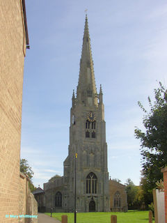
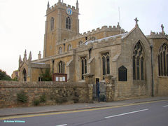
The place-name 'Warboys' is first attested in a Saxon charter of 974, where it appears as Wardebusc and Weardebusc. The name is perhaps from the Old Norse vardi and buski, and means 'beacon with bushes'. "Wearda" was also an Old English personal name, and it has been suggested this word means, literally, "bush of a man called Wearda", or, that the first element is from the Old English "weard" (‘watch, protection’). Additionally, the first Norman family to settle there was named Wardebois, whom, initially, according to John Leland, were named Verbois, from Verboys, near Rouen. The Verbois were known as the Wardebois, from at least 1199 to 1322.[6] After this period, the town's name shifted to Warbois, then, finally, Warboys.
The church of St Mary Magdalene, formerly of the Blessed Mary the Virgin, consists of a chancel, nave, north aisle, south aisle, west tower, north and south porches.
Nothing now remains of the church which existed as the time of the Domesday survey of 1086. The earliest church of which there is now evidence was built in the middle of the 12th century, probably when the church and its possessions were granted by Abbot Walter to the almonry of Ramsey Abbey. This church consisted of the present nave and a north aisle. The chancel arch, the responds at each end of the north aisle and a small piece of walling at the south-west corner of the nave of this church still survive.
Early in the 13th century, the Norman north aisle, with the arcade, was rebuilt and immediately after, the south aisle with its arcade was added. In the middle of the 13th century the west tower, with its broached spire of ashlar, was built, and it was evidently intended at this date to extend the aisles westwards to the line of the west wall of the tower. If this intention was then carried out, the south extension was rebuilt in the latter part of the 14th century when the south porch was added. The north extension was also rebuilt in the early part of the 15th century when the north porch was added.
The chancel was rebuilt and shortened before the beginning of the 19th century and, in 1832, it was extended eastwards apparently to its original length and considerably altered. At this date large galleries were erected in both aisles and the tower, the floor being lowered a foot to give headroom under them. The east wall above the chancel arch, and west wall of the tower, were cased in lath and plaster, a vestry was formed at the west end of the north aisle, all the walls were coated with thick plaster and wooden mouldings fixed below the clearstory window and in other places. The spire was restored in 1898 and in 1926 the tower and south aisle were underpinned. The additions of 1832 (except those to the chancel) were removed and the floor restored to its former level.
en.wikipedia.org/wiki/Warboys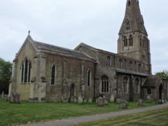
Fulbourn is a village in Cambridgeshire, England, with evidence of settlement dating back to Neolithic times. The village was probably established under its current name by 1200. The waterfowl-frequented stream after which it was named lies in the east, close to the division between arable and fenland.
In Norman times, Fulbourn was recognised as having five manors:[9] Zouches Manor, Manners Manor, Colvilles Manor, Shardelowes Manor and Fulbourn Manor. Of these five, only the last remains today.
In 1496, Richard Berkeley and his wife Anne Berkeley settled a debt of 1,000 marks with property that included the manors of Fulbourn, which were then listed as Zouches, Manners, Shardelowes and Fulbourn.
Archaeological evidence of habitation in the area has been found dating as far back as the Neolithic period, and there have been numerous finds from the Roman and Anglo-Saxon periods. The name has so far been traced back to 991 AD and is thought to derive from the Anglo-Saxon "Fugleburn" or "Fugolburna", meaning "stream frequented by waterfowl". At one time, the village had two ecclesiastical parishes with both churches in the same churchyard, separated by seven feet; All Saints, believed to be the earlier, and St. Vigor's. Some early maps depict "Fulbourn Magna" and "Fulbourn Parva" as separate villages, but a research project conducted by the Fulbourn Village History Society concluded that there was only ever one Fulbourn.
en.wikipedia.org/wiki/Fulbourn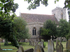
St. Benedict's [or St Benet’s] church, in Benet street, adjoining Corpus Christi college, is a building of stone in the Early Norman, Early English and later styles, consisting of chancel, nave, aisles, north porch and a western tower containing 6 bells: the tower, with its "long and short" masonry and baluster windows, is regarded as a Saxon work, and there are portions of similar work of the same period at the north-east and south-east angles of the nave: the church is connected with Corpus Christi college by a range of buildings carrying a gallery, which is now occupied as college rooms: the church was repaired and enlarged in 1856, and again during the period 1874-82, at a cost of £3,016, and affords about 350 sittings, of which 100 are free. The register dates from the year 1539, and records the burial, 12 Jan. 1630, of Thomas Hobson, the famous University carrier. The living is a vicarage, net yearly value £60, including 23 acres of glebe, in the gift of Corpus Christi college, and held since 1895 by the Rev. Charles Peter Littlejohn M.A. of that college.
[Kelly's Directory - 1900]
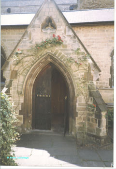
CHESTERTON is a parish and village, and the head of a poor-law union, giving its name to a hundred, and a portion of the parish, under the Boundary Act, 1868, has been included in the parliamentary borough of Cambridge. The village is a long, straggling place on the north bank of the river Cam, a mile and a half north from Cambridge station, in the Western division of the county, petty sessional division and county court division of Cambridge, and in the rural deanery of Cambridge and archdeaconry and diocese of Ely. The parish was constituted a Local Government District in 1880, but under the provisions of the Local Government Act, 1885 (56 and 57 Vict. c. 73), an Urban District Council has been established, and the parish divided into two wards, called the East and West.
The church of St. Andrew, picturesquely situated near the river, is a large and interesting embattled structure of flint, chiefly in the Decorated style with Perpendicular additions, consisting of chancel, clerestoried nave of seven bays, aisles, north porch and an embattled western tower, with a beautiful octagonal spire, and containing a clock and 5 bells: the chancel was restored about 1844, when a piscina and three sedilia of Late Perpendicular work were discovered: there are remains of Late screen and a roof of the 15th century: the nave is Decorated, but has a perpedicular clerestory and roof, some of the corbels bearing shields of arms: on the spandrels between the arches and in other parts of the church are remains of frescoes, c.1300: in the north aisle is a plain sepulchral recess; and both this and the south aisle have finely-carved corbels: the chancel still retains some good chestnut benches, richly carved: in the churchyard are several stone coffin slabs, bearing floriated crosses: there are 650 sittings, 600 being free.
The Baptist chapel, in Chapel street, was erected in 1842, and enlarged and restored in 1863: the Wesleyan chapel, in High street, was erected in 1858. The Congregational church, in the Victoria road, was built in 1884, at a cost of £4,000.
[Kelly's Directory - 1900]
The parish of St Luke was formed from parts of the parish of Chesterton St Andrew, and parts of the parish of Cambridge St Andrew the Less in 1881. The parish of St George was formed in 1938 from parts of Old Chesterton.
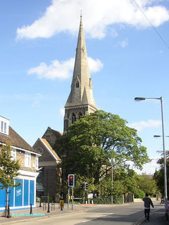
The parish registers of Manea commence in 1708. There are separate headings for baptisms and burials at Welch’s Dam for some years in the period 1711-1727. The Rev Evelyn Young who transcribed the marriages in the 1930s. believed that pages had been lost from the first register at both the beginning and the end. The entries are defective in the period 1714 – 1721. The first register ends in July 1748 for marriages, July 1749 for baptisms and in March 1749 for burials. The second register does not begin until December 1754 for marriages, June 1755 for burials and January 1755 for baptisms. Thereafter the registers are regularly kept. Manea was originally a chapelry of Coveney and entries concerning Manea people are perhaps to be found in the Coveney registers
Nancy Travers 1990
MANEA (or Maney), formerly a parochial chapelry and hamlet of Coveney, is now an ecclesiastical parish, near the old Bedford river and in the middle of the Fens of the Isle of Ely, with a station 1 mile north from the village on the Ely and Peterborough section of the London and North Eastern railway, 81 miles from London, 8 south-east from March and 9 north-east from Chatteris, in the North Witchford union. South Witchford hundred, petty sessional division, county court district and rural deanery of March, archdeaconry of Wisbech and diocese of Ely.
By Orders, which came into operation March 25, 1884, detached parts of the parishes of Downham, Wentworth, Witcham and Witchford, in the Ely union, were amalgamated with this parish. The church of St. Nicholas, erected at a cost of £4,000, partly on the site of the old church, and opened April 1, 1875, is a building of stone in the Early Decorated style. The register dates from the year 1708. There are Primitive and Wesleyan Methodist chapels.
[Kelly's Directory - 1929]
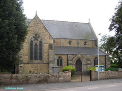
Easton is recorded in the Domesday Book of 1086 as a settlement consisting of ten manors, with 19.5 ploughlands (approximately 2,340 acres (950 hectares)) of arable land and 840 acres (340 hectares) of meadows. The village was a berewick of Spaldwick at the time, and was passed in 1109 to the Bishop of Lincoln as part of the appurtenances of Spaldwick. It later descended as part of the soke of Spaldwick and into the ownership of the Duke of Manchester.
The village's church, St Peter's, was built in the 11th Century, partially reconstructed in the 13th and 14th century and majorly rebuilt in 1781. A 14th century bell pit in the floor of the church's tower was uncovered in the 21st century. The church became a grade 1 listed building in 1958,.
en.wikipedia.org/wiki/Easton,_Cambridgeshire
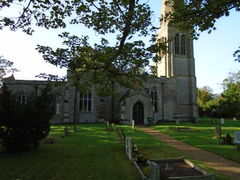
EAST HATLEY is a parish, about 3 miles south--east from Gamlingay station on the Bedford and Cambridge section of the London, Midland and Scottish railway, 7 north-west from Royston and about 13 south--west from Cambridge, in the hundred of Armingford, petty sessional division of Arrington and Melbourn, union of Caxton and Arrington, county court district of Cambridge, rural deanery of Shingay and archdeaconry and diocese of Ely. The Master and Fellows of Downing College are lords of the manor and sole landowners.
The church of St. Denis is a building of stone in the Early English style, there are some memorials to the Castell family, the former owners of the estate, including an altar tomb to Mrs. Constance Castell, ob. 1610, and a tablet to the Rev. W. Cray Say, a former rector, d. 1751: the church affords 100 sittings. The register dates from the year 1678.
HATLEY ST. GEORGE is a parish, 2 miles east from Gamlingay station on the Bedford and Cambridge line of the London, Midland and Scottish railway, 10 north-west from Royston and
about 14 south-west from Cambridge, in the hundred of Longstow, petty sessional division of Arrington and Melbourn, union of Caxton and Arrington, county court district of Cambridge,
rural deanery of Bourn and archdeaconry and diocese of Ely. Hatley Park is the seat of Ernest Ridgill esq. who is lord of the manor and the principal landowner. The church of St. George, built in 1352 and standing in Hatley park, is an edifice of stone in the Perpendicular style: there are memorials of the family of St. George, baronets, including a brass with effigy in armour to Sir Baldwin St. George, who died in 1425 the church was restored by the late John Carbery Evans esq. J.P. and re-opened in 1878, and affords 100 sittings.
[Kellys Directory of Cambridgeshire 1929]
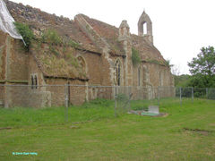
The University church of St. Mary the Great, which stands in the centre of the town, opposite the Senate House and University Library, is a spacious edifice in the Perpendicular style, consisting of chancel, clerestoried nave; aisles; south porch and a lofty western tower with octagonal buttressed turrets, and containing 12 bells and a clock, which replaced the older
one, erected in 1794, and presented in 1892 in memory of the Rev. H. R. Luard D.D. vicar 1860-87; the porch, a reproduction from drawings of one removed in 1805, was the gift of the
late W. H. Hattersley esq.; a spacious gallery surrounds the interior on the north, west and south sides, and there are a number of monuments, including one of the Jacobean period, with bust, to Dr Butler: the armorial glass in the windows, presented by S. Sandars esq. commemorates Henry VII. and forty other subscribers to the building of the church: here the University sermons are preached and are attended by the University authorities, heads of houses, professors and the members of the University generally; the heads of houses and professors sit in the chancel, masters of arts and bachelors in the body of the church, and the undergraduates in the gallery: the bell of this church is tolled during a quarter of an hour from six in the morning and again from nine in the evening respectively: the church was restored during the period 1861-92, at a cost of £7,400, and affords 1,400 sittings. The register dates from the year 1557. The living is a perpetual curacy, net yearly value £73, arising from 82 acres of glebe, in the gift of Trinity College, and held since 1887 by the Rev. William Cunningham D.D. of that college, and hon. canon of Ely and rural dean of Cambridge.
[Kelly's Directory - 1900]
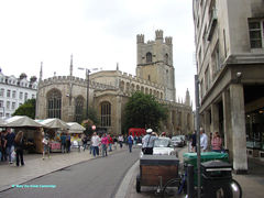
Haddenham is a village and parish, with a station on the Ely, Sutton and St. Ives branch of the London and North Eastern railway, 78 miles from London, south-west from Ely and 15 north from Cambridge.
The soil on the high lands is gravelly, and part stiff clay; subsoil sand; the whole of the fen lands have been drained and are in cultivation. The crops are sugar beet, fruit, wheat, barley, oats, potatoes end turnips. The area is 8,925 acres of land and inland water and a tidal water; the population in 1921 was 1,655, including Aldreth South, or Alderwith South, about 1½ miles south-west, and Hill Row West, 1 mile west, hamlets belonging to Haddenham.
[Kelly's Directory - 1929]
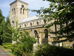
CHATTERIS in Domesday Book written "Cetriz" and "Cateriz", by some old authors "Chateriz" - is a parish and market town with a station on the Wisbech and St. Ives branch of the Great Eastern railway, 71 miles from London by road and 83 by railway, 19 south from Wisbech, 25-and-a-half north-by-west from Cambridge, 10-and-three-quarters north-by-east from St. Ives and 12 north-west from the city of Ely by road, but 26-and-a-half by railway.
The soil is clay, loam and fen land; subsoil, clay. The chief crops are wheat, barley, oats, mangolds, carrots and potatoes. The land around has been rendered very productive by draining and gaulting. The area is 13,638 of land and 36 of water; rateable value, £26,813; the population in 1891 was 4,587.
There are two cemeteries, both in New street: the Parochial cemetry, formed in 1856, covers an area of nearly 6 acres, with two mortuary chapels, and is under the control of the Urban District Council: the General cemetry was formed by a company in 1850 and is 3a. 2r. 13p. in extent.
The church of St. Peter is an ancient building of stone, in various styles, consisting of chancel, nave, aisles, south porch and an embattled western tower with a low spire containing a clock and 5 bells: the chancel is divided from the body of the church by a handsome screen: there are 750 sittings, 500 being free. The register dates from the year 1650.
[Kelly's Directory - 1900]
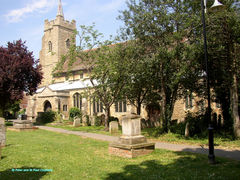
Yelling is in the former county of Huntingdonshire. It has had various spellings in recorded history, including Gellinge (11th century), Gylling (12th–15th century) and Illyng (16th century). The name is thought to be derived from the manorial family Gill or Gell. The village was listed as Gelinge, Gellinge and Ghellinge in the Domesday Book of 1086 in the Hundred of Toseland in Huntingdonshire. In 1086 there were two manors at Yelling and 25 households.
In 1932 the village was noted for its 17th-century houses and cottages, many of which are in the High Street. Church Farmhouse is a red-brick 17th-century house with a double-pile plan. The Old Forge is a 17th-century timber-framed house.
The Domesday Book of 1086 records a church in Yelling, but the oldest part of the present Church of England parish church of the Holy Cross is the north arcade, which was built around 1180–90. The south aisle includes two original 13th-century windows. The clerestory, south porch and west tower were built in the 14th century. There is a Mass dial on the southeast buttress of the south aisle.
The west tower has a ring of four bells. Christopher Graye of Haddenham cast the treble and second bell in 1666. Joseph Eayre of St Neot's cast the tenor bell in 1739 and the second bell in 1770. The bells are currently unringable. Holy Cross is a Grade II* listed building. The noted evangelist Henry Venn was Vicar of Yelling from 1771 until his death in 1797.
The village has a Baptist chapel, established in 1850. In 2016 there was a planning application on the notice board outside the chapel for it to be converted into a private home.
en.wikipedia.org/wiki/Yelling,_Cambridgeshire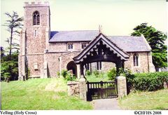
HORSEHEATH is a village and parish, pleasantly seated on the Cambridge old road, 4½ miles east from Linton station on the Cambridge and Sudbury line of the London and North Eastern railway, 4 west from Haverhill and 14 south-east from Cambridge.
Horseheath Hall, a magnificent mansion, erected here in 1665 by William, Baron Alington, was sold about a century later for the value of the materials: the park which consisted of above 870 acres has been disparked. T. Wayman Parsons esq. is lord of the manor and principal landowner. The soil is clay; subsoil chalk. The chief crops are wheat, oats and barley. The
area is 1,922 acres; the population in 1921 was 369.
The church of All Saints is an ancient edifice of flint and rubble in the Gothic style of the 15th century, consisting of chancel, nave, north and south porches and an embattled western tower
containing 4 bells: the church was restored and reseated in 1880-91, at a cost of £1,000: in 1911 six of the nave windows were completely restored at a cost of £166. The church affords 190 sittings. The register dates from the year 1558.
There is a Primitive Methodist chapel here.
[Kelly's Directory - Cambridgeshire 1929]
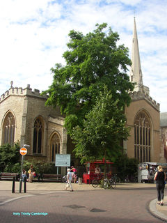
The parish of Holy Trinity, Cambridge is one of the original parishes of the town. The area of the parish covered part of the commercial centre of the town including the Eastern end of the
market and Market Street and extended towards the village of Barnwell as the latter was gradually absorbed into the town. Unlike many of the other central parishes much of the area within the boundaries of Trinity parish was garden and open land. The increase in the built up area of the parish, especially in the vicinity of Walls Lane [Kings Street] and Newmarket Road can be seen in the registers as new streets appear, with frequent changes of name.
Among the notable buildings in Trinity parish were Trinity hostel inhabited by law students until the mid sixteenth century, one of the earliest Non-Conformist chapels in Green Street and a number of well known inns, such as the Crane and the Black Bear in Market Street and the King’s Head in Sidney Street. Holy Trinity parish has always contained a large proportion of commercial property including Shoemaker Row (Market Street) and part of Market Hill, but today few people live within the parish boundaries. The church is surrounded by shops, large stores and offices, and much of the churchyard has disappeared with twentieth century road-widening schemes. Yet despite the changes which have taken place around it, the church of Holy Trinity still continues to fulfil its role as a parish church, drawing its congregation from a wide area.
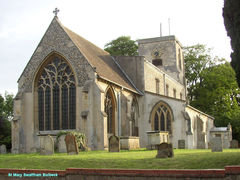
SWAFFHAM BULBECK is a parish, 2½ miles east from Bottisham and Lode station, and about the same distance from Swaffham Prior station, both on the Cambridge and Mildenhall
branch of the London and North Eastern railway, 6½ miles west from Newmarket and 8 north-east from Cambridge.
The church of St. Mary is an ancient edifice, chiefly in the Late Decorated style, consisting of chancel, clerestoried nave, aisles, two porches and a western tower containing 6 fine-toned
bells: the chancel was restored by the Ecclesiastical Commissioners in 1876-7, at a cost of £848; and during the period 1884-91, the roofs of the tower and aisles and portions of the interior were restored, a new organ erected, the south aisle reseated and a new pulpit and other fittings provided, at a total cost of over £356; in 1896 the interior was renovated by John Ashton Fielden esq. J.P. at a total cost of over £500: there are 458 sittings, of which 317 are free.
[Kelly's Directory - Cambridgeshire - 1929]
Doddington is a parish, formerly comprising the chapelry and market town of March and the hamlets of Benwick and Wimblington; but by an Act of Parliament passed in 1856, called "Doddington Rectory Division Act" (19 & Vict. C. 1), which came into operation on the death of a former Rector, in Nov. 1868, these places are now distinct parishes; it is in the Northern division of the county, hundred and union of North Witchford, Isle of Ely, petty sessional division and county court district of March, and in the peculiar archdeaconal jurisdiction of the Bishop of Ely. The village is on the main road between March and Chatteris, equi-distant 4 miles from each place, and 1¼ miles south-west from Wimblington station on the Cambridge, St. Ives and Wisbech branch of the Great Eastern railway.
A clock tower with four dials was erected in 1897, at a cost of £90, in commemoration of the Diamond Jubilee of Her late Majesty Queen Victoria; there is also a fire engine house.
Kelly's DIrectory 1912
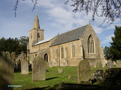
St. Ives is a parish on the north bank of the River Ouse and on the road from Huntingdon to Lynn; It was anciently called ‘Slepe’ and appears under the name in the Domesday book, but acquired its present name from Ivo, a Persian Bishop, who, it is said travelled through the land preaching, and at last came here, where he died about the end of the 6th century. It is 59 miles from London, 5 east from Huntingdon and 14 north east from St. Neots.
The Church of All Saints is an edifice of stone in the Norman and Perpendicular styles, consisting of chancel, nave with clerestory, aisles, North and South porches and a western tower with Spire and pinnacles containing 8 bells and a clock with Handel's chimes. The cemetery, on the northern outskirts of the town, and covering 2 acres, was opened in 1848.
Kelly's Directory 1910
The St Ives parish registers have been re-transcribed and will be uploaded to the online database in due course.
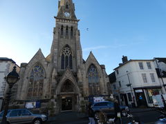
In the earliest register the village is Fulmer; later it became Foulmire and does not become Fowlmere until the middle of the 19th century.
FOWLMERE, in Domesday Book "Fugelesmare”, is a parish, 6 miles north-east from Royston, 2½ south-east from the Shepreth station on the Hitchin, Royston and Cambridge line of the London and North Eastern railway, and 9 south from Cambridge, in the hundred of Thriplow, petty sessional division of Arrington and Melbourn, union and county court district of Royston, rural deanery of Barton, archdeaconry and diocese of Ely.
The church of St. Mary is a fine structure of flint in the Early English, Decorated and Perpendicular styles, consisting of chancel, nave, aisle, transepts, north porch and a lofty embattled central tower containing 5 bells; there are two memorial windows, and there is also a monument to the Mitchell family, dated 1745 and 1748: the church was restored during the period 1870-90, at a cost of about £3,000, and has 250 sittings.
[Kelly's Directory - Cambridgeshire - 1929]
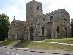
St Matthew's is an ecclesiastical parish, formed June 28, 1870, out of the parish of St. Andrew the Less: the church, in St. Matthew's Street, Barnwell built in 1866, is an octagonal structure of brick, opening into transepts on four sides, the roof being surmounted by an octagonal lantern: the eastern arm forms an apsidal chancel and there are north and west porches and a western belfry containing 3 bells: the church affords 580 sittings. The living is a vicarage, net yearly value £220, with residence and half an acre of glebe, in the gift of the vicar of St. Andrew the Less, and held since 1887 by the Rev. Joseph Hargrove M.A. of Clare College, Cambridge, and surrogate. St. James's, a wooden church in Ainsworth Street, in this parish, is served by the vicar and curates of St. Matthew's.
Kelly’s Directory 1929
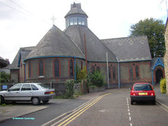
The church of St. Andrew, appears from the mandate of Bishop Arundell, dated at Downham 4 Dec 1376, and preserved in the diocese registry, was consecrated 12th Dec. in that year : it was originally Norman, and incorporated the materials of the original structure, but is chiefly an edifice of stone in the Early English and later styles, consisting of chancel, nave, north porch and embattled western tower containing 3 bells, dated 1671 : the east window is stained, and there is a memorial window to the Rev. H. E. Rackham M.A. vicar 1844-84, and one to the Rev. B. M. Lloyd, vicar 1884-1911 ; the font is possibly Norman, and the chancel has a piscina and a double aumbry, and there is another double aumbry in the north wall of the nave : the tower is Early English of the 13th century, and the nave and chancel are decorated of the 14th century : the church was thoroughly restored in 1851, and further restorations were included in 1887 : extensive repairs to the roof, rower &c. were completed in 1923, at a cost of £1,100 : there are 300 sittings. The register dates from the year 1778.
There is a Baptist chapel, erected in 1871, with sittings for 135 persons.
[Kelly's Directory - 1929]
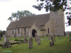
Wisbech St. Peter forms the town of Wisbech. Part of the ecclesiastical parish of Walsoken, Norfolk, was transferred to Wisbech from Norfolk in 1934. The church of SS. Peter and Paul is an edifice of stone in the Early Norman and Perpendicular style, consisting of chancel, double nave, lady chapel, north and south aisles, south porch and a large embattled tower at the north-west angle containing a clock and 10 fine-toned bells.
The Chapel of Ease or Octagon church, in the Old Market, is an octagonal embattled structure of brick, with stone facings, consisting of chancel, nave, south porch and a belfry containing one bell, and has sittings for 800 persons, most of which are free. The living is a perpetual curacy, net yearly value £602, from the Ecclesiastical Commissioners, in the gift of trustees, and held since 1895 by the Rev. Richard Boyer M.A. of Caius College, Cambridge.
Kelly's Directory - Cambridgeshire – 1929
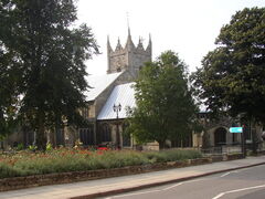
Farcet is a village and parish, on the old river nene, 3 miles southeast from Peterborough station on the great northern and great eastern railways, and 16 NE from Huntingdon. The parish was formerly a chapelry of Stanground.
The church of St. Mary is a small but ancient building of stone, dating from about 1200, and chiefly in the Gothic style, the tower being Transition Norman: it consists of clerestoried nave, aisles, south porch and a western tower with pinnacles, containing 3 bells.
The soil is part fen and part loam; Subsoil, clay and gravel. The chief crops are wheat, oats, potatoes, beans and peas. The area is 4467 acres of land and 20 of water.
[Kelly Directory 1914]
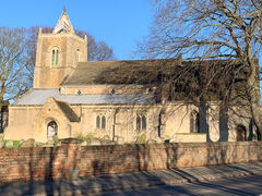
GRANTCHESTER, in Domesday 'Grantesete' and 'Grauntsethe,' and supposed by some to be the 'Grantaceaster' of Bede, is a parish and village, pleasantly situated on the west bank of the river Cam or Granta, 2½ miles south-west from Cambridge town, 3½ south-west from Cambridge railway station, in the Western division of the county, Wetherley hundred, Chesterton union, Cambridge petty sessional division and county court district, rural deanery of Barton and archdeaconry and diocese of Ely. The Bourn Brook, which separates this parish from Haslingfield, here joins the Cam, which separates the parish from Trumpington.
In 1912, by Local Government Board Cambridge (Extension) Order, 1911, an area of 167 acres from this parish was added to the borough of Cambridge for civil purposes
The church of St. Andrew is a building of clunch and rubble, with stone quoins and buttresses, in the Decorated and Perpendicular styles, and consists of chancel, nave of four bays, south aisle, north porch and an embattled western tower containing a clock and 3 bells. The register dates from the year 1539.
The Baptist chapel was built in 1876 and enlarged in 1891.
[Kellys Directory of Cambridgeshire 1929]
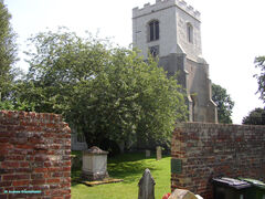
The church of St. Giles, rebuilt in 1875-6 near the site of the old church in Castle street, at a cost of £8,000, is a structure of white brick, with stone dressings, in the Early French Gothic style, consisting of chancel, lofty nave with wagon roof 65 feet from the floor, aisles and a side chapel: in the south aisle is a Norman arch built from materials removed from the old church: there is one bell hung on the outside of the west wall of the nave, and above it is a clock: the church affords about 800 sittings, of which 500 are free. The register of baptisms dates from the year 1596; marriages and burials, 1607; the registers of St. Peter's, dating from 1586, are also kept here.
[Kelly's Directory - 1900]
It should be noted that the registers for St Giles are in very poor condition for some periods and several years are illegible or missing.
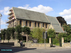
Burwell is an extensive village and parish, including part of the hamlet of Reach, with a station on the Cambridge and Mildenhall branch of the Great Eastern railway, and is 5 miles north-west from Newmarket, in the Eastern division of the county, hundred of Staploe, Newmarket union, petty sessional division and county district, rural deanery of Fordham, archdeaconry of Sudbury and diocese of Ely.
The church of St. Mary, at the south end of the village, is a light and elegant structure in the Late Perpendicular style. The register dates from the year 1562, and contains an account of a calamitous fire which took place in 1727, when a barn in which about 140 persons were assembled to witness a puppet show took light from the accidental firing of loose straw, and about 80 persons perished.
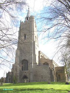
MARCH is a parish and market town and the head of a county court district and petty sessional division, with an important junction station on the Great Eastern and Great Northern railways, 88 miles from London by rail, 29 north from Cambridge, 14 north-west from Ely and 9 south from Wisbech, in the Northern division of the county, hundred and union of North Witchford, Isle of Ely, rural deanery of March and in the peculiar archidiaconal jurisdiction of the Bishop of Ely.
The town is now divided into four ecclesiastical parishes which, with three others, were formed out of the parish of Doddington subsequently to 1863, according to the provisions of the Doddington Rectory Division Acts, 10 and 11 Vict. c. 3 (1847) and 19 and 20 Vict. c. 1 (1856).
The church of St. Wendreda, anciently a chapel to Doddington, and about a mile from March bridge, on the London road, was originally erected about 1346.
[Kellys Directory of Cambridgeshire 1900]
The parish of St Mary was formed from part of March St Wendreda parish in 1868.
The Parish of St John was formed in 1872 from parts of March St Wendreda. Although there is no Burial Ground for March St John – all burials took place in the adjoining Station Road cemetery – there are 2 gravestones in the churchyard – those of the Reverend Edward WELLS, his wife Kate Caroline and a daughter Agnes Marion.
The parish of March St Peter was formed in 1881 from parts of March.
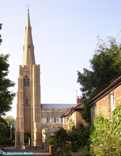
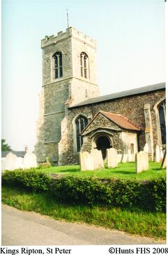
Kings Ripton [or Ripton Regis] is a parish, 3 miles south east from Abbots Ripton station on the main line of the Great Northern railway, and four northeast from Huntingdon. The Church of Saint Peter is an ancient edifice of rubble, in the perpendicular style, consisting of chancel, clerestoried nave of three bays, N aisle, Southport and an embattled western tower containing 2 bells.
The soil is clay; subsoil, clay. The chief crops are wheat, barley and beans.
Kelly’s Directory of Huntingdonshire, 1914.